
MATTERPORT SCANNING IN QATAR
EIWAA brings your dream building into the digital age with Matterport scan to BIM services using high-resolution Matterport laser scanners and software. Whether you are organizing your design concepts, keeping a facility portfolio, or planning renovation or refurbishment, our Scan to BIM solution ensures accurate as-built documentation by creating precise, intelligent 3D models or BIM models in Revit or IFC formats. Our cutting-edge Matterport Scanning services are customized to the AEC (architecture, engineering, and construction) industries for interactive digital twin models, streamlining every step of design and facility management. In order to create interactive virtual models, also known as 3D tours, virtual walkthroughs, or digital twins, Matterport technology provides a 3D spatial data platform for 3D rendering.
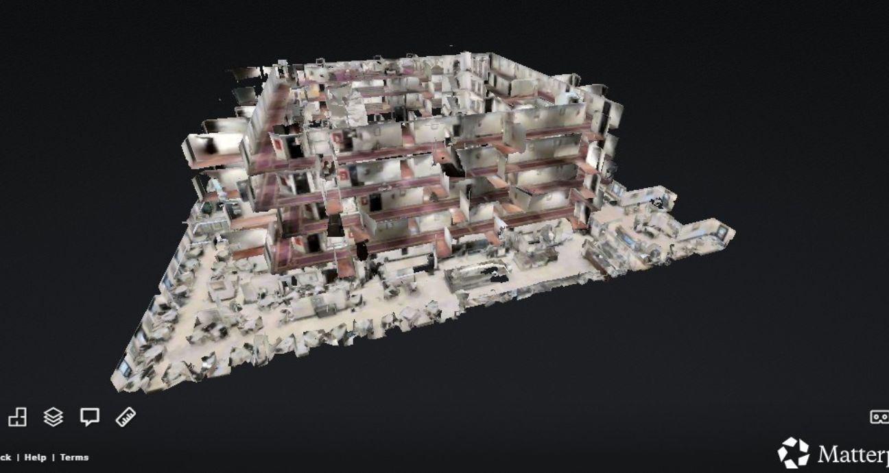
We create realistic 3D digital twins of actual locations using Matterport scanning services. Our Matterport scanning services provide real-time data for as-built documentation of buildings, construction sites, and architectural sites. Through Matterport Scanning services, we offer precise and efficient documentation to capture and digitize the as-built features of your buildings. Matterport 3D scanning services offer accurate floor plans, high-resolution 3D walkthroughs, and scan-to-BIM model delivery. The following services are provided by our architects and design engineers to help contractors, real estate firms, and property developers:
3D scanning services offered by Matterport are,
- Construction Progress Scanning: We monitor milestones and progress, reduce changes and downtime, and increase stakeholder participation by using virtual walkthroughs and 3D tours.
- Building & Facility Scanning: For major maintenance, space planning, renovations, or refurbishments, digital recordings of as-built conditions and surveys of as-built structures and facilities are created.
- Architectural Scan-to-BIM : Improving accurate 3D models and generating floor plans and Revit models from scans to design processes.
3D MATTERPORT SCANNING SERVICES IN QATAR
As-built documentation, as-built modeling, and digital twins for building condition assessment and structural integrity inspection of building structures can all benefit from our Matterport Scanning services. We employ Matterport Pro 3D scanners to produce accurate floor plans, digital twin models, and 3D walkthroughs for building scanning and inspection services. The following is a list of how to use Matterport 3D scanning services.
- Our technician visits your property or buildings using a Matterport camera, LiDAR iPhone, or Pro2 camera.
- To gather 360° imaging depth data, each selected region or space will be scanned from every angle in order to generate a spatial model.
- The Matterport cloud will receive all of the registered scanned data, which will be automatically stitched into a navigable 3D model and utilized to generate floor plans, elevations (PDF/DWG), 3D tour links, and 3D walkthroughs.
MATTERPORT SCAN TO BIM IN QATAR
With our Matterport Scan to BIM services, we transform 3D capturing reality into intelligent 3D models. In short, the process involves using a 3D laser to carefully scan your surroundings and producing BIM models in the Revit (.rvt) or IFC formats. With our Matterport Scan to BIM services, you can swiftly and precisely transform 3D scans into complete Revit models suitable for design, construction, and building contractors to use for facility management, maintenance, and retrofitting. These are the BIM service deliverables from Scan Matterport.
- After the Matterport scan, IFC or Revit (.rvt) models are sent to BIM services.
- 3D as-built documentation and precise point cloud processing.
- Precise digital twin models; deliverables for scalable architectural, MEP, and structural usage
- BIM deliverables (IFC/Revit)
- Fast, precise, and remote scanning
- Rework is decreased by accurate as-built data.
- Matterport 3D scanning data of your area using LiDAR-capable equipment or Matterport Pro2.
- BIM models with high accuracy derived from real-time monitoring data.
- Two-dimensional sketches and floor plans