3D LASER SCANNING IN ANGOLA
Are you looking for 3D laser scanning services for FPSO offshore platforms, offshore rigs, ships, and vessels in Angola? EIWAA handles all the major brownfield projects for laser alignment surveys and accurate dimensional inspections by advanced laser trackers, 3D scanners, and total station surveying instruments. EIWAA Oil and Gas Services provides 3D laser scanning and LiDAR design in Angola for all upstream, downstream, and brownfield FPSO projects. We offer 3D laser scanning of topside modules, hull structure, turret mooring systems, riser systems, piping, and instrumentation systems. 3D laser scanning of reality capture measurement includes point cloud processing, scan-to-CAD modeling, design validation and class detection, and digital twin integration as the core activities.
In ships and vessels, 3D laser scan data are utilized for accurate as-built designs and retrofitting solutions for hull structures, bow thruster units, exhaust gas scrubbers, and ballast water treatment systems. Our naval architects capture real-time data and generate point cloud registration and modeling by advanced software like Cyclone, Navis Works, SolidWorks, and FARO Scene with 3D scanners. Design validation, digital twin integration, clash detection, and 3D modeling with accurate dimensional verification are all included in the overall process of 3D scanning in FPSOs, yachts, ships, and offshore platforms.
OFFSHORE 3D SCANNING IN ANGOLA
EIWAA is the right offshore 3D laser scanning solution in Angola for as-built documentations, as-built modeling, asset integrity, offshore inspections, and structural integrity verifications. Our advanced 3D scanner captures real-time spatial data of offshore jackets, platforms, and FPSOs. If you are looking to hire a 3D scanning service provider for offshore FPSO scanning and modeling as retrofitting and reverse engineering solutions, enjoy the benefits of zero downtime, continuous support, and target completion at on-time execution plans.
3D LASER SCANNING SERVICES IN OIL AND GAS
Oil and gas 3D laser scanning services replace traditional surveying. With real-time capturing/measurements, record millions of data points at 360 degrees and create a 3D point cloud. Our Oil and Gas 3D Scanning Services utilize oilfield companies, oilfield consultants, and offshore drilling platform companies for accurate coordinate measurements, color images, as-built models, CAD drawings, and BIM data.
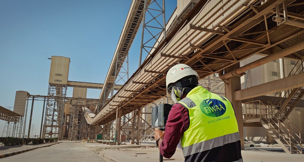
WORKFLOW OF 3D LASER SCANNING SERVICES IN ANGOLA
Our accurate and mutually agreed-upon 3D scanning schedule for meeting the client targets mainly depends upon the execution of professional 3D scanning workflows. This 3D scanning workflow is a professional and technical approach of a team of naval architects, 3D laser scanning surveyors, 3D modelers, georeferencing engineers, clients, and consultants.
The workflow of 3D laser scanning services in oil and gas services is,
- Accurate measurements of steel structures, pipe works, pipe layout, and routing
- Extract the details of plans, elevations, and side views for engineering documentation.
- Develop 3D models for all types of brownfield, upstream, and downstream projects.
- Data registration, clash detection, layout optimization, and data alignment
- Directly import 3D point clouds to CAD or BIM software
- Integrating Digital Twinning and Modeling
3D LASER SCANNING SERVICES IN OFFSHORE PLATFORMS
Our 3D laser scanning in marine and offshore platforms is used for detailed engineering, asset integrity inspection, design of piping systems, and structural analysis. 3D scanning of floating platforms for offshore oil production is used for piping routing and turret alignment.