LiDAR SCANNING IN ANGOLA
Looking for excellent precision LiDAR scanning services for FPSO’s, offshore rigs and marine vessels in Angola…? We capture detailed as-built conditions of FPSOs and floating offshore platforms, including top sides, piping systems and ship construction, which enables us to assure accurate scan-to-CAD modeling, dimensional control and digital twin design. We are dedicated to offering offshore LiDAR scanning solutions for dimensional control, clash detection and scan-to-CAD workflows to improve engineering quality, reduce rework and increase safety. We are a high precision offshore LiDAR scanning company that specializes in offshore scan to CAD, digital twin services, 3D laser scanning and LiDAR inspection services for Marine vessels.
EIWAA is the right option for delivering accurate 3D data for offshore engineering, inspection, refurbishment, maintenance, and retrofit brownfield projects. We help all oil, gas, oilfield, and marine companies to reduce rework and improve fit-up accuracy. Our offshore platform LiDAR scanning helps to generate high-precision 3D data capture for oil & gas assets, enabling accurate as-built modeling, inspection, and retrofit planning for oil and gas contractors.
LiDAR SCANNING SOLUTIONS IN ANGOLA
As part of supporting engineering, inspection, maintenance, and retrofitting, we provide offshore LiDAR scanning solutions for high-definition 3D data capture for oil and gas platforms, floating offshore FPSOs, and marine vessels. Our offshore LiDAR scanning services include LiDAR site assessment, control point setup, 3D laser scanning, point cloud registration, and scan-to-CAD modeling with as-built data to improve decision-making capabilities. As one of the top LiDAR scanning companies, our qualified surveyors and metrology engineers meet international standards like International Organization for Standardization (ISO), American Petroleum Institute (API), and DNV guidelines.
We provide offshore LiDAR scanning solutions of dimensional control, clash detection, retrofit engineering, digital twin development, structural inspection, and pipe spool verification. We are the leading oil and gas 3D laser scanning company for dimensional control and offshore LiDAR scanning solutions.
LiDAR SURVEY SERVICES IN ANGOLA
EIWAA LiDAR Survey Services serves oil and gas companies, offshore companies, FPSO owners, rig owners, and offshore consultants for accurate dimensional control of equipment and structures onboard. Our LiDAR survey services are used in major brownfield and upstream projects of retrofitting and reverse engineering projects in FPSOs, offshore rigs, ships, vessels, and yachts. Digital twinning, total station survey, 3D modeling, and offshore structural dimensional control services are performed by our naval architects with the help of advanced non-intrusive remote scanners and software.
OFFSHORE PLATFORM LiDAR SCANNING IN ANGOLA
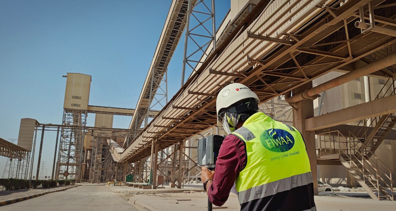
EIWAA is an enclave of experienced LiDAR scanning surveyors for performing offshore platform LiDAR scanning survey services. With advanced LiDAR scanners and software, we help all types of alignment surveys and as-built surveys at floating offshore production platforms (FPSOs), ships, and vessels with utmost accuracy. We are always using advanced ATEX-certified LiDAR scanners for offshore platform LiDAR scanning services.