
SCAN TO BIM SERVICES IN ANGOLA
Our services include terrestrial scanning, topographic mapping, bridge structural assessment, real-time monitoring, scan to CAD, CAD design, and drafting in Luanda and Soyo, making us one of the best scan to BIM providers in Angola. Using LiDAR data collecting and point cloud surveying, we provide 3D LiDAR surveying, 3D surveying, and topographic surveying services. Among the services provided by Scan to BIM Solutions in Angola are Point cloud to BIM, Survey to BIM, Scan2bim, and Scan to CAD. EIWAA Oil and Gas services is Scan to BIM service company for providing 3D laser scanning, data processing, BIM modeling, integration with pre-existing models, documentation and analysis, Scan2bim services, BIM collaboration, and BIM coordination services. Scan to BIM Solutions is the process of using 3D laser scanning or photogrammetry to transform physical structures into digital data and 3D models. Physical structures may onshore/offshore structures, infrastructures, Onshore and offshore buildings, facilities, hotels and restaurants etc.
TERRESTRIAL SCANNING SERVICES IN ANGOLA
EIWAA Oil and Gas provides terrestrial scanning services in Angola including topographical mapping, site scanning, ground LiDAR services, bridge lidar scanning, and geospatial analysis of bridges and mountains. Unmanned aerial vehicles (UAVs) or drones, photogrammetry, GPS surveys, total station surveys, ground penetrating radar (GPR), and terrestrial laser scanning are some of our surveying activities. High-resolution and detailed representations of environments, structures, and terrain can be created through Terrestrial Scanning Services. We are taking pictures of buildings or other things at ground level is part of terrestrial photogrammetry and terrestrial imaging services to provide accurate data collection and analysis.
Our LiDAR Services collects high-resolution spatial data on the earth’s surface and structures by using LiDAR technology at ground level. 3D maps of the terrain are created through HD 3D mapping for use in landscape modelling and urban planning. Site surveys, construction monitoring and as-built documentation services are provided by the LiDAR Surveying and mapping services. Our Scan2BIM and Terrestrial Scanning Services includes but not limited to,
- Laser Scanning: High-precision LiDAR scanners are used to collect data and generate point clouds that precisely represent the sizes and spatial connections of structures.
- Point Cloud data processing: Data registration for Point cloud to BIM must be done using 3D software.
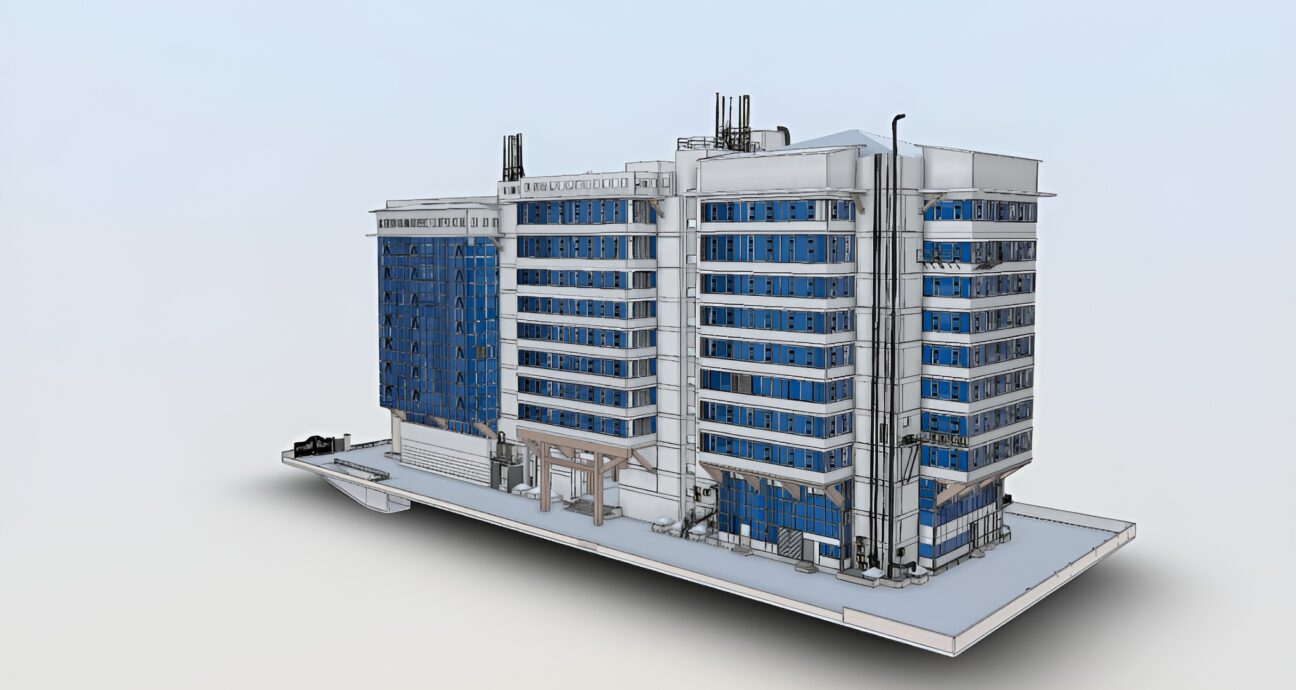
- 3D Modeling: 3D modelling is the process of creating a 3D BIM model utilizing advanced software.
- BIM Integration: We are updating current BIM models with as-built conditions and ensuring precise as-built representations as a scan to BIM solutions.
- BIM Documentation and BIM analysis: 3D visualization, geospatial scanning and analysis, and BIM documentation services are all included in BIM documentation and analysis.
- BIM Collaboration and BIM Coordination: Our Experienced Design engineers collaborate and coordinate BIM services from Point cloud to BIM, Scan to BIM, and Scan-to-Model.
Scan to BIM Solutions
3D Visualization
Mountain Terrain Modeling
Structural Assessment of Bridges
Point Cloud to BIM
LiDAR Survey
TOPOGRAPHIC MAPPING SERVICES
The process of creating intricate 3D maps of the landscape, including contours, structures, elevations, and landforms is known as topographic mapping services. Services for topographic mapping include boundary and land use analysis, elevation changes, terrain analysis and GIS/GPS integration. We offer structural assessment of bridges, bridge modeling ,life cycle analysis and bridge LiDAR scanning through our Topographic Mapping of bridges.
CAD DESIGN AND DRAFTING
Topographical surveyors, pipeline integrity inspection engineers, heritage BIM services and plant design and modeling services are all aided by our CAD design services.
FREQUENTLY ASKED QUESTIONS
We provide 3D mapping, 3D visualization, visual data capture, terrestrial imaging, and reality capture as part of our photogrammetry surveying services in Angola. Maps and 3D models of real-world objects and structures are produced using photogrammetry services.The two categories of photogrammetry services that we offer are terrestrial and aerial photogrammetry. Our remote sensing surveying services cover all aspects of surveying and mapping solutions, including image-based surveying, 3D mapping, 3D visualization, and mapping, among other things. Drone surveying services that capture visual data are utilized for both terrestrial and geospatial imaging services.
Topographic Mapping Services of Bridges, Mountains and Structures.
- Initial Concept Stage (LOD 100): Conceptual parameters and basic detailing
- Schematic Design(LOD 200):Convert conceptual drawings into structural design using schematic design.
- Detailed Design(LOD 300):It is a refined structural design that includes precise measurements.
- Construction stage Detailing (LOD 400):Convert design into intricate structures at the construction stage.
- Asbuilt Detailing(LOD 500):The quality degree of detailing is related to as-built detailing (LOD 500).