
STOCKPILE SURVEY SERVICES IN OMAN
EIWAA is one of the top stockpile survey services in oman for providing stockpile measurement survey services, Aggregate Quantity Survey , Earthworks Survey, Stockpile Quantity Survey Services and storage tank dimensional survey by laser measurement services. EIWAA Oil and Gas Services is the stockpile survey services in oman for providing stockpile measurement survey, Aggregate Quantity Survey services, Earthworks Survey services and Stockpile Quantity Survey Services by laser measurement services.
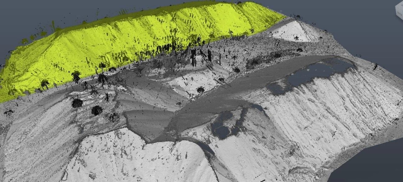
EIWAA Stockpile measurement services by laser measurement is the top quantity survey company in oman for stockpile volume survey, stockpile quantity surveys and earthwork surveys. Stockpile quantity survey Services in oman involve the accurate measurement and as-built survey of aggregates, coal, or minerals. For accurate stockpile quantity survey services in oman, we are providing stockpile measurement survey by LiDAR 3D laser scanning and GIS Survey. Earthworks Survey Services and Stockpile measurement survey relate to each other, and it shall be performed by accurate LiDAR scanner and terrestrial scanner with advanced 3D Modeling software.
More precise and effective quantity surveying services and estimation for earthworks projects are made possible by the combination of 3D scanning survey with GIS. For earthwork surveys, stockpile volume surveys, and stockpile quantity surveys, EIWAA Volumetric Survey Services in oman is the best quantity survey company. Accurate volume calculation services , stockpile volume survey, earthworks survey and quantity measurement survey services are critical for project bidding and execution in the mining and construction sectors. LiDAR scanning and Geographic Information Systems (GIS) services in oman provide more precise estimating for earthworks, quantity surveying and stockpile volume surveys.
AGGREGATE QUANTITY SURVEY SERVICES
The location and distribution of possible natural aggregate deposits should be studied using our remote sensing and aerial geophysical measurement services in oman, which is used to identify and mapping exposed bedrock units and surficial deposits. Both compositional data based on physical attributes and spatial information detailing the surface and subsurface features . Digital measurement services are gathered by remote sensing equipment and can be readily integrated into Geographic Information System databases after being processed, examined, and interpreted by computer methods.
Remote Sensing measurement
Geophysical measurement
Digital Measurement
3D Mapping and Surveying
Laser Measurement
Volume Calculation Services
EARTHWORKS SURVEY SERVICES IN OMAN
The process of precisely measuring and tracking the movement of soil, bedrock, and materials on a building site is known as earthwork volume monitoring services in oman. This helps to effectively manage costs and schedules by ensuring that excavation, filling and grading operations are in line with project specifications and requirements. For applications in quantity surveying, mapping, and 3D modeling, georeferenced point clouds—sets of 3D data points collected from actual locations and precisely fit to geographic coordinates—allow for an accurate spatial representation of physical objects, terrain, or structures.
LASER MEASUREMENT SERVICES
Our Laser measurement services include storage tank peaking/banding survey, verticality checking and measurement services, roundness survey, ovality measurement services and more. As a Laser measurement company in oman we are using EODR Laser measurement techniques. It is a remote sensing and non-contact dimensional measurements for all types of storage tanks including EFR storage tanks, IFR storage tank and fixed roof type storage tanks.
FREQUENTLY ASKED QUESTIONS
non-intrusive remote scanning using sophisticated 3D modeling tools for LiDAR, GIS, and total station surveys.
For the objectives of annual and biannual stock verification, quantity surveys are regularly needed in the mining, fertilizer, material, and oilfield industries.
Lidar scanning is used to measure the foundation and shell settling, check for ovality and roundness, measure verticality and plumpness, peaking/banding, and other aspects of storage tank dimensional management.