3D LASER SCANNING IN UAE
EIWAA is the right 3D laser scanning company in the UAE to provide point cloud surveys and point cloud scanning to enable 3D scan to BIM services in oilfields, petrochemical plants, and storage tank terminals. EIWAA is the definitive 3D scanning solution for 3D imaging, 3D mapping, digital mapping solutions, as-built surveys, as-built documentation, spatial scanning, and reality capture measurements for buildings, civil and architectural companies, and HVAC industries. Our 3D scanning experts are proficient in 3D modeling using Leica, Cyclone, Recap, and FARO Scene software. A single source for point cloud generation, point cloud scanning, registration, clash detection, and georeferencing of data, which helps to reduce manual error and improves the accuracy and precision. Our 3D scanning survey experts worked for onshore and offshore platform structures of ADNOC, ENOC, and Borouge storage tank terminals, buildings, airports, hotels, and restaurants.
For accurate 3D survey solutions of industrial plants, oil and gas facilities, commercial buildings, and brownfield modifications, we are using advanced laser scanning solutions. Our 3D scanning specialists capture millions of accurate laser measurement points within minutes to create highly detailed engineering and 3D imaging of existing assets and equipment. We provide accurate as-built drawings, intelligent 3D models, and as-built documentation to help MEP companies, construction, and architectural building engineering consultants.
3D SCANNING SPECIALIST SERVICE IN UAE
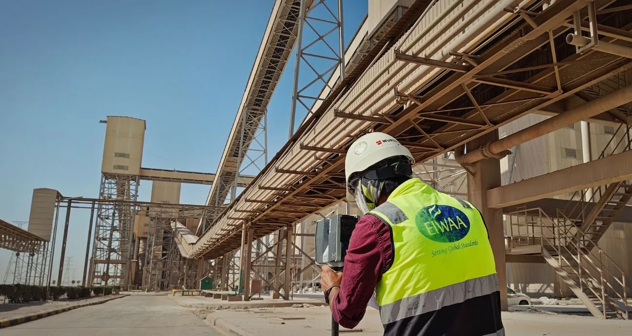
We are the best 3D scanning specialist service for industrial laser scanning of refineries, petrochemical plants, power generation facilities, manufacturing plants, and process plants. Industrial laser scanning is a non-contact 3D surveying technology that uses laser beams to capture the accurate geometry of buildings, pipelines, storage tanks, and industrial assets. As a 3D scanning specialist service in the UAE, we replace traditional measurement methods and provide comprehensive site data with millimeter accuracy.
3D IMAGING IN UAE
If you are looking for 3D imaging services subsequent to the laser scanning activities at industries and oil fields, EIWAA is the right choice for structural drawings, BIM models, Revit models, AutoCAD models, Navisworks models, and digital twins. In 3D imaging services, we are providing professional reports compiled with the major requirements of clash detection and engineering survey reports.
REALITY CAPTURE MEASUREMENT IN UAE
Laser scanning and reality capture measurements of buildings and infrastructure provide conditional assessments and real-time monitoring. Infrastructure and building scanning measurements include commercial buildings, industrial warehouses, airports, bridges, ports, roads and highways, and utility corridors. Deliverables of our reality capture measurement services are registered point cloud data, color images, 2D CAD drawings, as-built drawings, and general arrangement drawings.
3D SCANNING SURVEY IN UAE
Our 3D scanning survey services fulfill your requirements by systematic workflow and its applications. We execute brownfield engineering projects, as-built documentation, plant expansion and modification, asset integrity management, and digital twin development of all commercial and infrastructure development.
- Brownfield Engineering Projects: We are minimizing downtime, risks, and other potential hazards by providing accurate scan data that enables engineers to design modifications with utmost quality.
- As-built Documentation: Create as-built drawings and models for industrial assets where the existing drawings/data are missing or outdated.
- Plant Expansion and Modifications: Reality Capture Measurement of as-built conditions before installation, piping re-routing, structural upgrades, or facility expansion projects. Clash detection: Identifying all relevant design conflicts and its alignment
- Asset integrity management: Managing assets by maintaining repair and maintenance reports with valid inspection and certifications.
- Digital Twin Development: Creating intelligent 3D models and virtual replicas for industrial facilities and equipment.
POINT CLOUD SURVEY IN UAE
Individual points are collectively known as a “point cloud” and are the accurate digital representation of spatial scanning data of plants, structures, and buildings. Point Cloud Survey Services is the one that uses 3D scanners or photogrammetry to capture millions of precise measurement points. These billions of XYZ coordinates captured during point cloud scanning and point cloud surveys contain X, Y, Z positions, color information, and density values. Point cloud scanning provides a digital 3D representation of buildings, airports, industrial plants, and storage terminals.