
TERRESTRIAL LASER SCANNING IN UAE
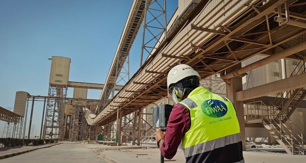
Partner with us for the terrestrial Laser Scanning Service that provides As-built documentation, Architectural façade and interior scanning, BIM Model Creation (Revit/AutoCAD) and MEP System coordination (HVAC, Piping, Electrical). Our Terrestrial Scanning of Airports, Hotels, Restaurants and Heritage architectural building supports renovation, construction and facility management companies. Structural Analysis and deflection measurements of bridges and architectural buildings renovation projects, we use advanced laser scanning to get high accuracy and construction verification. Terrestrial laser scanning companies help construction and structural design companies to get 3D point cloud data,2D CAD Drawings, BIM Models, Digital Twin models,3D Visualization outputs and clash detection reports.
For accurate TLS Services, We combined advanced terrestrial laser scanning to engineering survey to serve industries of construction, real estate, Aviation, Airports, Oilfield, infrastructure and transport and ADNOC projects. Innovative and high-definition heritage terrestrial scanning services, specialized in non-invasive scanning. We deliver 3D Digital documentation, Architectural detail capture, structural condition monitoring, virtual reality, digital heritage modeling and archeological site mapping.
TERRESTRIAL SCANNING SURVEY IN UAE
Terrestrial Scanning Survey have significant role in the infrastructural development and feasibility study of Airports and Aviation industries. Airport scanning services includes terminal building scanning, hangar and maintenance facility scanning, baggage handling system scanning, conveyor scanning, BIM and digital twin development. We provide comprehensive terrestrial laser scanning solutions for airport structures, renovation, repair and maintenance. Terrestrial Scanning Services of Airports and infrastructure buildings are,
- Runway, Taxiway and Apron Survey
- Airport Terminal building terrestrial scanning and As-built documentation
- Hangar and maintenance facility terrestrial scanning
- Baggage handling system mapping
- Airport obstacle and clearance survey
- Navigation aid lighting system mapping
- Airport expansion and master planning support
- Airport conveyors and cargo handling system scanning
We transform point cloud data into BIM Models and digital twin for facility management, airport expansion, terminal renovation, utility mapping and construction verification.
TERRESTRIAL LiDAR SCANNING IN UAE
Our Terrestrial LiDAR Scanning combines Terrestrial Survey, Scanners and Software’s starting from initial data acquisition through point cloud processing,3D Modeling, Revit Models and Scan to BIM etc. Industrial Laser Scanning Services covers Point cloud survey, As-built survey, Terrestrial laser scanner survey, Industrial laser scanning and BIM Laser scanning across oilfield, oil and gas and Refineries.