
Marine 3D Scanning
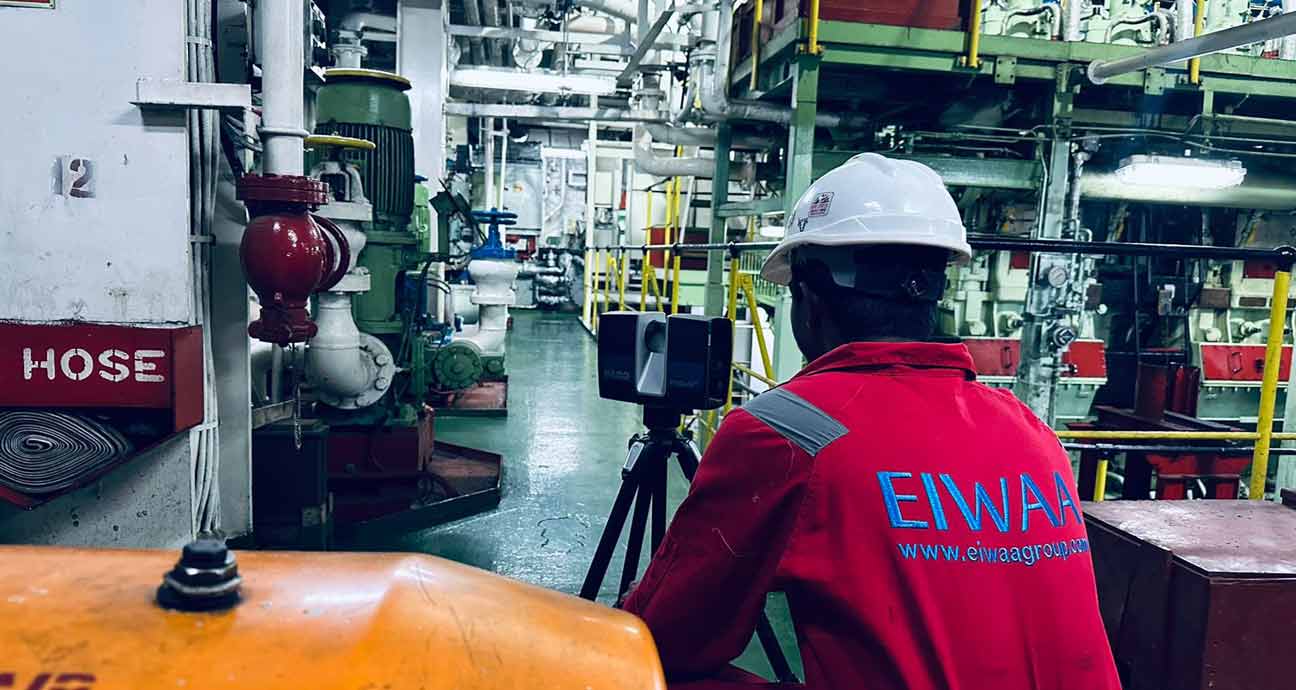
EIWAA, Marine Scanning Specialist in Marine Survey providing 3D Laser scanning service and 3D Modeling in mm accuracy for retrofitting engineering and marine service solutions. From a point cloud, the designers can develop a model of a structure and/or ships, its machinery, piping, and equipment for Concept Design – Basic, Detailed, and As-Built Engineering. Detailed engineering covers the scope of 3D Laser scan data to visualize onboard piping system and as-built information. 3D scanning is by advanced Laser scanner for generating As-Built drawing, and precise documentation etc.
3D scanning Service for Ballast water treatment System (BWTS) installation used as an initial step for retrofitting/conversion of BWTS Installation as a part of feasibility study. Marine 3D scanning service and Modeling of Ballast water treatment System (BWTS) installation is used to capture the “as-built” conditions of the ship or vessel prior to the retrofitting and installation.3D Laser scanning of Yacht, Ship and boat methodology includes Scanning plan formulation, Feasibility Study, point clouds refinement, point cloud isolation,3D Modeling Service and Engineering etc.
LiDAR Scanning and Modeling of Ships and Vessels
LiDAR 3D Scanner uses LiDAR technology to enable 3 dimensional geometric scanning by triangulation method in marine scanning Services. 3D Capturing of complex ship geometry surfaces by FARO Laser scanner and extraction for dimension, angle etc.by 3D Modeling service software’s used in marine by Naval Architects and Design Engineers. Our 3D modeling services provide precise 3D laser measurement services and as-bult engineering results.
- BWTS Retrofitting Engineering
- Hull Air Lubrication System
- Boat and Yacht Retrofitting
- Conversion Engineering
We offer 3D laser surveying services for BWTS scanning, installation of ballast water treatment systems, 3D laser scanning of hull air lubrication systems, EGCS scanning, and other core naval architecture services for marine retrofitting alternatives. The range of services covered by 3D Rendering, 3D Visualization, and 3D Modeling includes Ship Sounding, Manual Sounding, Ship Tank Ullage Survey, Ship and Barge Tank Calibration, and more. The major ports of UAE and IACS classification societies have approved our Marine Services including 3D Scanning and Modeling Services for high-quality solutions in Naval Architecture and Marine Engineering.
Ship Building
Retrofitting Engineering
Conversion and Upgradation
Why EIWAA Marine Services?
EIWAA Marine Services offers 3D Laser scanning and Detailed Engineering of BWTS, EGCS and Hull Air Lubrication System in Ships & Vessels. 3D Laser imaging is a non-contact and NDT technology in Marine Survey that digitally capture and create point cloud. For all kinds of maritime retrofitting and conversion engineering solutions, EIWAA is among the top marine survey companies in UAE, offering LiDAR scanning Services, 3D scanning, and marine laser scanning services.
- 3D Imaging
- Reality Capture
- 3D Modeling
- Boat and Yacht 3D Measurement
Frequently Asked Questions
The use of laser scanning and 3D Modeling Service in the shipbuilding industry is a technology that aids shipyards in completing projects more quickly, effectively, and safely.
Real-time data or As built data can be captured by 3D laser scanning instrument. As-built survey, reality capture, and existing conditions survey are examples of frequent uses in offshore rigs and vessel retrofitting. Sequencing, scheduling, and simulations for construction are the steps for Reverse Engineering and retrofitting solutions.
To accomplish best practices for boat maintenance, new building, and (BWTS) Ballast Water Treatment Systems retrofit, Hull air lubrication system retrofitting engineering; we are specialist in quickly and precisely recording current conditions utilizing the most advanced, well-proven technology in laser scanning and precision elevation. We worked with naval businesses and industry experts to provide shipping firms with high-quality services at all Major ports.
When completing ship checks, it is customary to have designers and/or engineers on board, where they measure the current systems and areas with tape measures. The scope and construction papers are then developed using these measurements. To account for differences between the measurements and reality, allowances must be made due to the measurement uncertainty.